
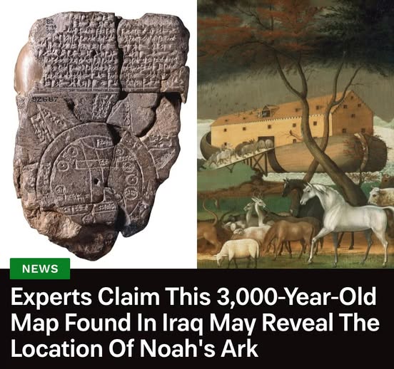
In 1882, the British Museum acquired the oldest known map of the world, which was carved into a clay tablet from Babylon and is known as the Imago Mundi. Dating to the seventh century B.C.E., it depicts ancient Mesopotamia, including cities like Babylon and the Euphrates River. However, much of the cuneiform inscribed on the 3,000-year-old tablet remained a mystery — until now.
Researchers from the museum recently translated the text and determined that it includes references to the Babylonian version of Noah’s ark, including instructions on how to get to the mountains where its remains lie — the very same mountains mentioned in the Bible as the ark’s final resting place. Learn more about this groundbreaking discovery: